The Impact of Remote Sensing
‘Remote sensing’ refers to the use of satellites, drones, and other aircraft to collect data from the Earth’s surface. In recent years, these technologies have transformed how we interact with nature by facilitating in-depth analysis of global landscapes. With access to cost-effective and efficient ways to collect environmental data, we can better understand our planet and the effects of climate change—enabling us to take action based on concrete evidence.
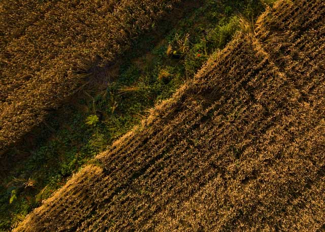
When it comes to agriculture, remote sensing tools can provide key data to support regenerative practices while reducing risks. With satellites and drones, we can rapidly analyze the potential of farms by characterizing the landscape in nuanced detail. This allows experts to select optimal areas for project implementation, soil sampling, and biodiversity assessments to complement labor-intensive field visits.
This is particularly important when you consider the scale of commercial farms, which can make field assessments prohibitively expensive and difficult to carry out. Imagine a farm in rural Australia with an area of 2000 hectares—the equivalent of more than 3700 football fields, spread across valleys and roadways. It’s not a flat piece of land, so you can’t see from one point to the next, and its remote location is only accessible through an unpaved road. This vast landscape is nearly impossible to analyze without the support of technology.
Remote Sensing and Soil Health
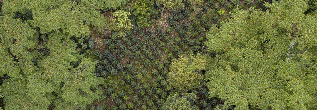
Remote sensing enables us to target key soil metrics from the sky, collecting indicators that lead to ideal testing sites for soil organic carbon (SOC), such as elevation, water flow patterns, and signs of erosion.
SOC provides essential data for regenerative agriculture, measuring the carbon stored in soils in the form of organic matter—including decomposed plant and animal residues—which plays a crucial role in soil health and fertility, carbon sequestration, and climate change mitigation.
The impact of regenerative agriculture on soil quality is a major benefit since soil degradation is a growing threat to agricultural yields, farmer livelihoods, and food security worldwide. Estimates suggest that 13% of global soils, including 34% of agricultural land, have already been significantly degraded.
Remote Sensing in Pasture Management for Australian Wool
Remote sensing is not only valuable for agricultural companies. It also enables more effective decision-making in the management of livestock in the Australian wool industry.
Australia is the world’s largest wool producer, raising sheep on more than 85 million hectares of farmland. Unfortunately, Australian wool farmers face increasing environmental challenges due to climate change—including higher risks of severe droughts, which threaten key natural resources like water and grazing pastures.
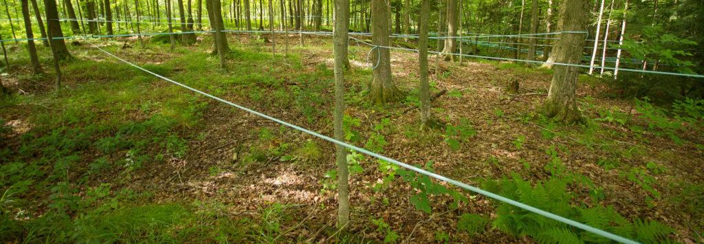
To address these challenges, PUR uses remote sensing to map out entire wool farms. Experts separate the landscapes into different areas of productivity using three different layers of mapping technology: NDVI, elevation, and K-Gamma. This enables the project team to create distinct zones within farms that have specific environmental characteristics—informing the installation of fence lines and paddocks to maximize the efficiency of pasture management.
By using data to clearly understand where to put sheep, and for how long, remote sensing technology becomes a management tool that vastly increases the efficiency of regenerative practices, like rotational grazing, grass sowing, and tree planting. This technology can help enhance the long-term health of pastures, while also restoring soils, sequestering carbon, and protecting local water sources.
Regenerative Agriculture is the Future
With improvements in computation and the wider availability of environmental datasets, remote sensing technologies have become effective tools for farmers to make informed decisions about regenerative agriculture. Using data to accurately map farms not only supports real-time strategy, but also provides key insights into the future.
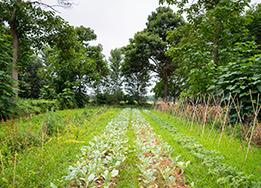
The best part: regenerative agriculture is completely customizable for farmers, who can adopt the specific practices that make the most sense for their land—such as cover cropping, rotational grazing, and agroforestry. Remote sensing offers farmers accessible, cost-effective information to help design their own approach to regenerative agriculture that makes sense on their farm; rather than a one-size-fits-all solution that, ultimately, doesn’t fit everyone.
According to Paul Hrycyk, Global Regenerative Agriculture Lead at PUR, “Farms are all as different as the farmers who run them.” To motivate farmers to adopt more regenerative practices, it’s better to provide tools and data that empower them to make their own decisions about the future of their land. With the right technology, we can show agricultural leaders and workers how regenerative practices are the best option for their future livelihood—while also restoring the ecosystems we all depend on.